
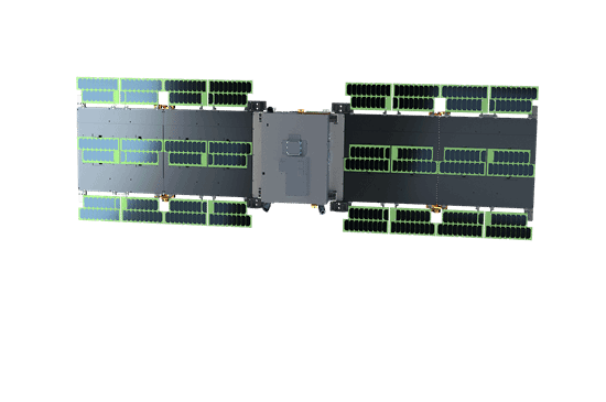
Model of the HiSea-1 satellite. [Photo/en.xmu.edu.cn]
In the vast expanse of space, the satellite HiSea-1 stands out as China's first small C-band Synthetic Aperture Radar (SAR) satellite, jointly developed by Xiamen University (XMU), the Tianyi Research Institute and the 38th Research Institute of China Electronics Technology Group Corporation (CETC).
Weighing only 185 kilograms, it offers high-resolution Earth observation regardless of night or adverse weather conditions.
Previous C-band SAR satellites designed for ocean monitoring typically weighed several tons, incurring substantial development and launch costs.
The key to HiSea-1's lightweight design lies in the integration of the satellite platform and radar payload. The team consolidated traditionally separate components – solar panels, radar antennas, and more – into a slim, board-like structure, concentrating essential functions in minimal space.
Achieving high performance in such a compact body posed significant technical challenges. The radar requires substantial power to capture clear images, yet all systems must operate without interference.
Through optimized electronic layouts, commercial-grade components, and modular design, the team succeeded in delivering powerful observation capabilities within a compact frame.
HiSea-1 is equipped with an active deorbit device, allowing it to safely burn up in the atmosphere at the end of its lifespan, avoiding the creation of space debris.
The satellite's SAR operates by emitting microwave signals that bounce off Earth's surface, generating high-resolution imagery like a bat's echolocation.
With a maximum resolution of one meter and an imaging width of up to 100 kilometers, it can revisit designated areas every three days, enabling frequent monitoring of dynamic targets. Microwaves penetrate clouds, rain, and fog, providing all-weather, round-the-clock observation.
From ocean monitoring to disaster response, HiSea-1 has proven invaluable. It supplied timely imagery during emergencies such as the eruption of the Hunga Tonga-Hunga Ha'apai volcano and severe flooding in Henan province.
Looking ahead, the satellite will serve as the lead satellite of the HiSea Constellation, forming a network for more comprehensive observation of Earth.
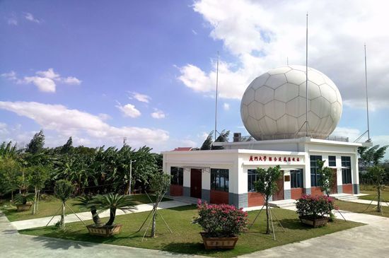
XMU's station for joint remote sensing receiving. [Photo/en.xmu.edu.cn]
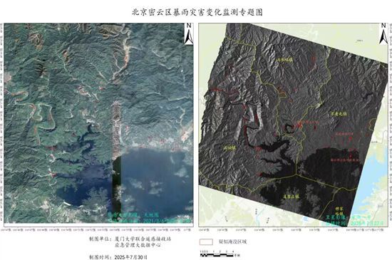
Thematic map shows changes in the rainstorm disaster in Miyun district, Beijing. [Photo/en.xmu.edu.cn]


